Available
Not Available
Not Available
Available
Available

IGIplan - Mission Planning Software
Availability
Description
IGIplan - Mission Planning Software
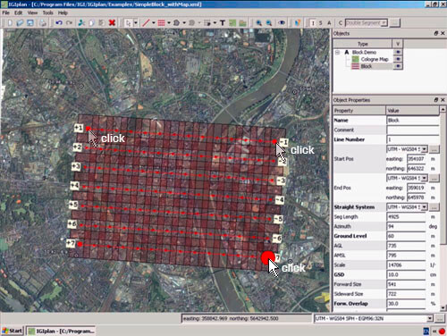
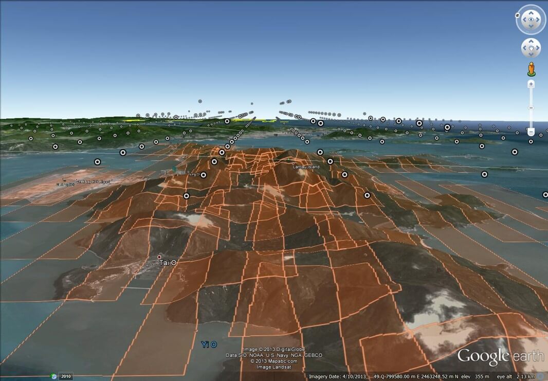
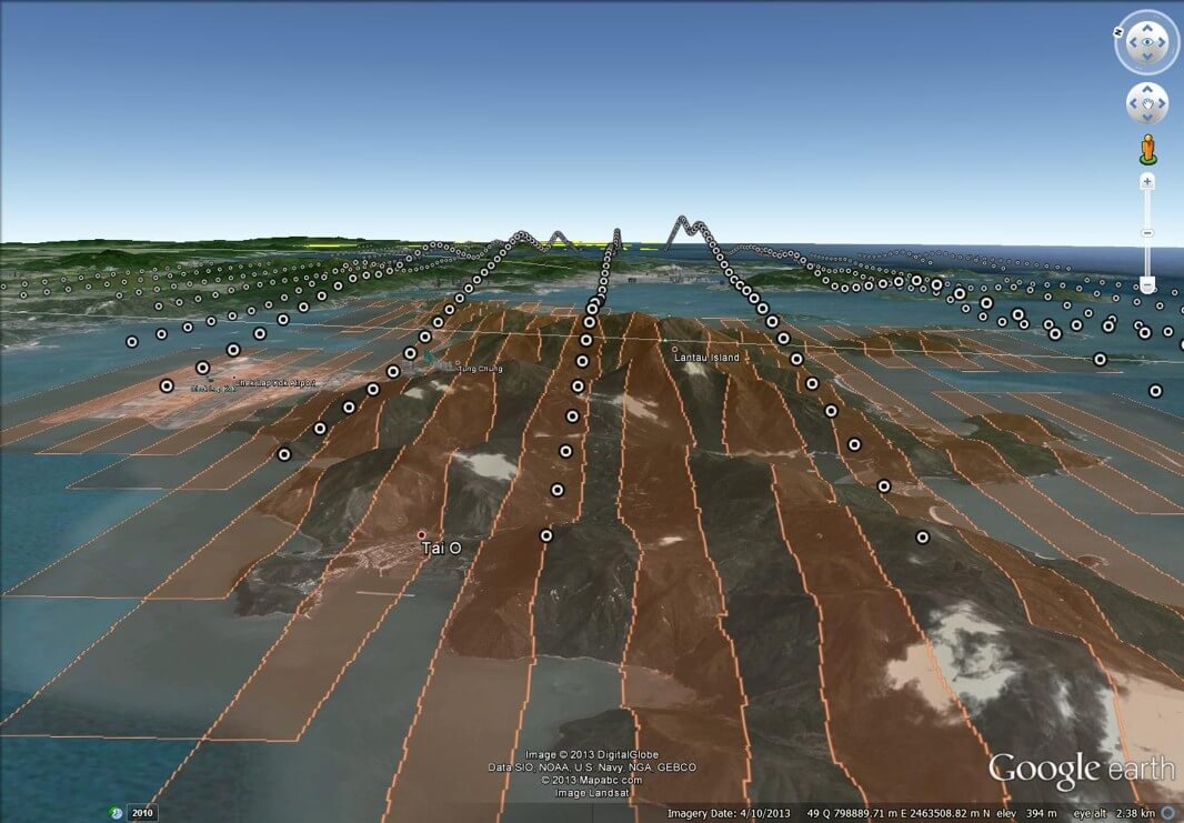
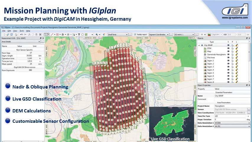
IGIplan is mission planning software designed for aerial surveys. It supports 600+ local coordinate systems and integrates with all aerial sensors and the CCNS flight system for streamlined planning and execution. The software features real-time flight line calculations and an intuitive interface for efficient operation. It includes BingMaps and GoogleEarth compatibility for familiar result visualization.
Features Include:
- Local Coordinate Support
- Worldwide DEM Support
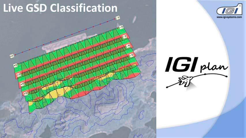
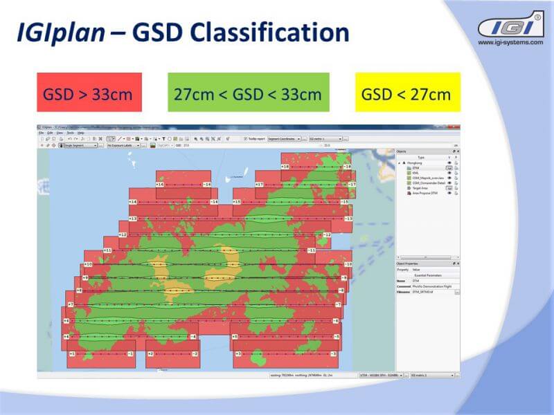
- Online GSD Classification
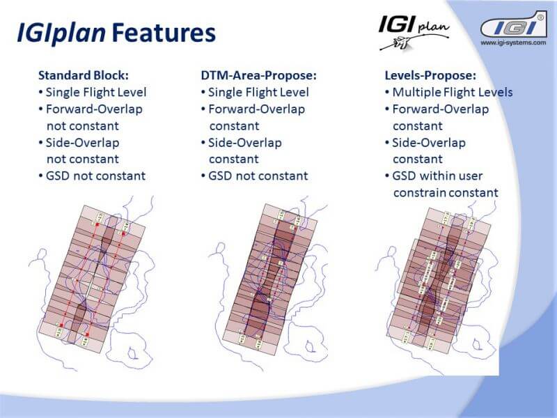
- Automatic Flightplan Creation
- Terrain Following Planning
- Various Import/Export
- Multiple Sensor Support
- Inquire for full technical specifications
License Types:
- Evaluation License
- Time-limited trial version
- Local License
- Single hardware dongle enables use on any computer
- Only one active installation at a time
- Ideal for mobile users working across sites
- Network License
- Enables concurrent users on shared network
- Number of simultaneous users limited by licenses purchased
- Best for office teams or distributed users on VPN
- Users queue if maximum concurrent limit reached
Gallery


No items found.
Request a Quote
Get in touch directly with our sales team
Newsletter
Join +15K active subscribers
Stay in the loop! No spam. Ever.


Company
Aerial Survey Products
Aircraft Marketplace
Cookie Preferences
